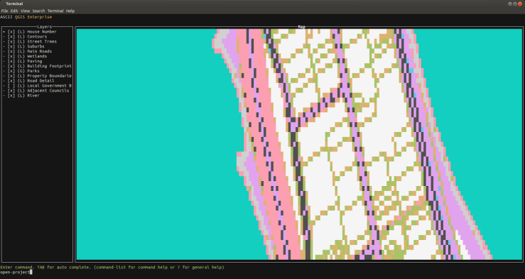
Have you ever thought “gee I wish I could have a ASCII QGIS map viewer for console use. I’m so over these fancy UIs with their fancy graphics, fonts, and icons”.
No?
Anybody?
You are still reading? OK good I thought I lost you.
Anyway. Here is a fun idea. A ASCII QGIS map viewer that renders your project files in a console window (with colour possible). Still with me?
This project was mainly just a bit of fun to play with the curses Python library and QGIS. What started off as a random idea on the train seems to have turned into full “usable” thing, if viewing a project and the legend is considered usable.
If you are still with me and itching to see it in action here it is. In all the ASCII glory
Nifty!
What can it do so far?
- Load project
- Pan
- Zoom
- Set colour mode on/off

The code is up at https://github.com/NathanW2/ascii_qgis (or http://nathanw2.github.io/ascii_qgis/)
It’s a bit of a fun side project at the moment so you might find bugs as I have only tested it on my machine.
Follow the README on github for notes on running.
Have fun.
Filed under: Open Source, qgis